Wednesday, February 25, 2015

The State of Modern Archaeology and Astronomy: Thundering Acclaim for the Thunderbird Challenge or Not?


The response to our Thunderbird Challenge for the world's archaeologists, astronomers and archaeoastronomers has been overwhelming, as modern students particularly, first as a trickle, and then in droves, having grown up in an era of instant answers via digital technology, the Internet and Wikipedia, Android and iPhones -- now via E-Mail, WhatsApp, PushBullet, Facebook, Skype and even via the antique SMS -- report to us of their experiences with the encrusted structures they are facing in academia at colleges and universities throughout the world, whose esteemed specialists have been unable to answer our two simple questions. No one out there has been able to answer both.

What goes on behind the scenes in campus life in the ivory towers of learning?

Two readers sent us their secretly taped sessions as examples, one with famed archaeologist Archie Digg and one with esteemed astronomer Astella Skop.

Archie Digg was met emerging from his walk-in private safe at the museum which he curates. In that safe he keeps his -- actually, the university's -- archaeological treasures under his personal lock and key. The museum has enough physical assets to make a banker's mouth water, with 90% of the holdings kept so deep in cellars, that they never have been and never will be exhibited. Indeed, much in the dungeons has never even been catalogued.

Even access to the library of ancient books and manuscripts requires Digg's special permission, seldom granted. Digg has a list of publications as long as his arm, writings based on those books and manuscripts. The last thing that interests him is giving others access to those treasures. It is like the Turin Canon viz. Papyrus which disintegrated over decades in an archaeologist's chest of drawers because the archaeologist thought he could decipher it ultimately himself, not wanting to give anyone else a chance. By the time others got their hands on it, it was in a thousand pieces. Have or not have.

Digg pointed out to the inquiring student that he was quite busy negotiating a contract with a major publisher, by which he would edit and supervise the publication of a series of volumes containing photographs of the archaeological treasures under his control together with his subordinates' commentary about them, from which he would make a nice profit, monetarily and professionally. Archaeology was a big business, and Digg had his hands at the controls.

Digg snorted upon being asked about the Thunderbird petroglyph and sneezed out a sincere professional answer in which he pointed out that the student completely misunderstood the nature of archaeological inquiry.

"Do you realize", Digg proclaimed, squinting through his glasses, "that our profession is at the forefront of trends in research? If you had done your homework you would know that Archaeology has kept in step with theoretical developments over past centuries."

"In the early years of Archaeology," said Digg, "excavations were oriented to the ruling classes, major cities, great temples, palace architecture, and fine arts. Collectionism and Orientalism prevailed." Digg thought about his many vaults, chock full of exotic artifacts from the eras of "get it while you can".

Digg continued in a nearly forced dignified and serious manner, as if to justify whatever had happened in the past, even if archaeology in its early stages was often nothing more than the looting of foreign lands. Digg emphasized: "Collectionism was  replaced subsequently in the course of time by an emphasis on science, which led to a methodological focus on cultural history, i.e. the creation of historical timelines based on artifacts previously obtained."

"What naturally followed," said Digg, "was the Processual Archaeology of the 1950s and 1960s, which used to be called the New Archaeology. After the artifacts had been timelined in the era of Scientifc Methodology, the focus turned to humans and their societies, and, let me quote my colleague, Colin Renfrew, things then turned to "the underlying historical processes which are at the root of change", for as Renfrew noted, Archaeology "has learnt to speak with greater authority and accuracy about the ecology of past societies, their technology, their economic basis and their social organization. Now it is beginning to interest itself in the ideology of early communities: their religions, the way they expressed rank, status and group identity."

"Of course," said Digg, "societal views are many and varied and Archaeology kept pace with those as well. In the 1970s and 1980s, there was an emphasis on Urbanism, with the attendant aspects of architecture, environmental considerations, populations, and political life. We thus saw Structuralist and Systems approaches, and even Marxist analysis." Digg knew his stuff.


"Today", mused Digg, as if exhorting in himself what he viewed to be inevitable, "Archaeology is right in the middle of applying post-modern and post-processual theory and examining phenomenological approaches. Phenomenology questions the often claimed objectivity of rational science and suggests that much in Archaeology is subjective.

Archaeologists are thus instead now looking to place themselves experientially in the shoes of ancient peoples to sense subjectively what it was like to be there in any given era, through this subjectivity thus making archaeology more real in its conclusions.  It is a form of archaeological existentialism, as in Johan Hegardt, The Existential Possibility: The relevance of archaeology and cultural heritage today, which writes in the Abstract:
"In this text it is stressed that rescue archaeology, archaeological education and research at the universities, and the cultural heritage management at large, is systematically obstructing the political and democratic agenda to make ... cultural heritage more pluralistic and multi-vocal. In this article I argue that the reason behind this political and social problem, can be found in laws and regulations, a methodological and epistemological canon, and in an essentialist perspective. This very complicated and complex situation is understood and analyzed in a historical and social context and through a discussion of the question of existence and Being."
"Assuredly", said Digg, closing the safe door on his treasures, "there are many advocates of Cartesian rationalism who chafe at the idea that there is no objective archaeological reality, but the trend is clear. In modern terms, there is a movement to make Archaeology relevant to real life. You can feel it."

Digg suddenly adopted an austere appearance, asking gravely: "And now, you want me to know something about petroglyphs and astronomy? My dear student, what does THAT have to do with our profession. You mean this Kaulins simply wants to know what really happened in our human past based on some indecipherable scribbles on ancient walls? Good grief. Do not waste my time! I must be going. I have an important group caucus appointment where we are discussing Stonehenge as an ancient Ayurvedic retreat, yoga inclusive!"

So now let us turn to astronomy. To realize how important astronomy is, or can be, one should ponder that "The Little Prince" (Le Petit Prince) by Antoine Saint Exupéry (the hyphen is not found in his birth documents), published "legally" first in 1946, our birth year, is said to be the world's second most widely read book, after the Bible, so Artcurial. We seem to be destined to follow in the track of Asteroid B612, the home of the hero of Exupery's book.

Spark Notes writes inter alia about the themes covered in the book:
"The little prince represents ... open-mindedness .... He ... asks questions .... The novel suggests that such inquisitiveness is the key to understanding and to happiness....

Saint-Exupéry shows that spiritual growth must also involve active exploration....

The narrator places drawings into the text at certain points ... his illustrations are simple, they are integral to understanding ..."
It is much like our own writings.

In "The Little Prince" a Turkish astronomer discovers a new asteroid, unveiling his discovery at an international astronomy conference, but no one believes him, because he is dressed as a Turk, gesticulating at a blackboard and pointing to mathematical equations -- just like astronomical drawings in our writings.

The Turkish astronomer attends a second conference later in the book, dressed as a Westerner, and his discovery is resoundingly accepted. Well, Andis Kaulins is not Turkish, but perhaps we should reveal to the world that the real name of yours truly is Harry Alnwick Potter, and that my friends just call me "Annick".

Now, what about the astronomers? The esteemed astronomer Astella Skop cordially received a student who wanted to know the answers to the questions presented in the Thunderebird Challenge. Astella was a distinct gender minority in astronomy, a profession ruled almost entirely by the male profession (ca. 96% of professors in astronomy are male).

"The problem with astronomy", said Skop, to the inquiring student, "is gender. We have known now from various studies for several centuries already, that the level of human civilization is directly proportional to the status of women. The higher their status, the higher the level of civilization."

She continued, "There is nothing surprising about this. The reason is provided by studies of guinea pigs. If all the guinea pigs in a birth cycle are male, then the "physically strongest viz. biggest" male is the chief of the group. If there is only one female in the birth group, then it turns out often that the "loudest" and not the strongest or biggest male is the chief. Women bring in a new component, so that things other than sheer brute force become important ... and that is the beginning of civilization."

"Wow" said the student, "so what led you to such a male-dominated academic discipline as astronomy?" 

"Well", said Astella Skop, "as a young girl I read ""The Little Prince" (Le Petit Prince) by Antoine Saint Exupéry and it seemed to me to be so right philosophically about humanity and the world, that I was drawn strongly to astronomy. In some way, we are all like the Turkish astronomer, just waiting for the right fashion in the right era, when our time to blossom has come. I have quite an exclusive status, and I like that."

"Right", said the student, being reminded of her purpose there. "What do you think of the Thunderbird Challenge? and can you answer the second question. If Kaulins is right, why have archaeologists and astronomers not discovered these things long ago."

Astella Skop laughed, "You will have trouble finding a modern astronomer who can answer that sky map question about visible stars in prehistoric days. There are very few astronomers who are interested in the history of astronomy or in simple planispheres, especially ancient ones. They really do not want to know that their profession's beginnings were humble, just as any technology.

And for God's sake, don't mention Archaeology. That's an "Earth" thing and these are "Sky" people. Most modern astronomers are "aeronautical" and think in terms of the cosmos. Just look at what has been in the astronomical news in recent days. It is all about a belching black hole in the middle of our galaxy that could eventually wipe us all out ... in billions of years. That is the kind of thing that interests modern astronomers. It has little relevance to life on Earth now or in the past. "History" is an undesired, too simplistic word, for astronomers.

Even the so-called archaeoastronomers reject the idea that they study the "history" of astronomy. Theirs is a cultural thing, and they like all kinds of mathematics, as if numbers were a safeguard against nonsense, which, of course, they are not. If you are merely trying to prove that something ancient shows stars in the sky, that is too simple for all of them, and they want to hear nothing of it. They prefer seeing a sun-dial and/or lunar calculator in every prehistoric garden, as if the ancients needed to constantly check the same solar or lunar alignment data they already had long ago. It is all rather wild."

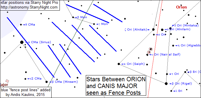
Astella Skop continued, "The only real answer to your question is to read the works of Andis Kaulins in this field. He is simply interested in what really happened in the past and how the ancients viewed the skies. Having surveyed land in his youth, he is also interested to discover the degree to which primitive astronomy, viz. sky-gazing was used to conduct land survey. One does not have to agree with all of his conclusions, but one definitely should read what he writes. Most of my colleagues do not do so because they feel threatened by ancient astronomy as showing their high tech discipline to have primitive roots, which of course it has, and has to have. Everything started small, like a child. And, quite the contrary, it is rather amazing how much the ancients already knew about things like precession, the location of the ecliptic and celestial equator, and so on. The things that Kaulins produces are valuable. Read them."

Tuesday, February 24, 2015

The Great Thunderbird Challenge for the World's Archaeologists, Astronomers and Archaeoastronomers : One Petroglyph and 60 Stars!

The Great Thunderbird Challenge for the World's Archaeologists, Astronomers and Archaeoastronomers is now underway.

If you are a student, teacher, researcher, or administrator at a college or university, but are not professionally active in those professions, ask your local archaeologist, astronomer or archaeoastronomer if they know the answers to either of the two questions below. Give them a chance to show their stuff.

What are the Questions for the Challenge?

My friends tell us that in our work we should give the alleged and so-called mainstream "experts" in the archaeological, astronomical and archaeoastronomical communities more of an opportunity to show their stuff.

Accordingly, before publishing our next bundle of postings on "The Great Mound, Petroglyph and Painted Rock Art Journey of Native America",
we have decided to give the mainstream experts a chance... before our next bundle of postings hits the press....

First, Question 1, we would like to know from the archaeologists where the petroglyph redrawn below is located geographically. We know, of course, where it is, and if you are in none of these professions, don't waste your time looking online. You won't find it there. This petroglyph thus far languishes in obscurity, but, to the credit of the archaeological profession, it IS published. Where is it?


Second, Question 2, to illustrate the essence of "The Great Mound, Petroglyph and Painted Rock Art Journey of Native America", which has appeared in 18 postings, with many more to come, but has similarly languished in undeserved obscurity, which we intend to remedy here, we now ask of the astronomers: 
"Is there a group of visible stars (star magnitude limit 6.0 or brighter) out there that looks EXACTLY like that petroglyph? 
Gee, astronomers, nothing familiar? Here is some assistance. 60 stars!


We are not interested in chance similarities. Rather, at a star magnitude limit of 6.0, the default setting at e.g. the top astronomy software program Starry Night Pro (http://astronomy.starrynight.com/), we expect that this group of stars -- if it exists, as we know it does -- should have EXACTLY the number of stars noted above in the image for the corresponding section of that image -- and note that those numbers reflect EXACTLY the number of cupules (cupmarks) on that petroglyph, a petroglyph probably 5000 years old. 60 stars! Is that astronomy?!! In any case, you can be sure that WE know the answer.

This challenge should be a piece of cake for the world's astronomers, who spend much of their lives observing the stars. Could they have missed something this obvious?

We will proceed shortly to our next bundle of postings on "The Great Mound, Petroglyph and Painted Rock Art Journey of Native America" and when you know our next destination, you will be close to solution of the "Challenge" in terms of a location for that petroglyph.

We repeat. The Great Thunderbird Challenge for the World's Archaeologists, Astronomers and Archaeoastronomers is now underway. If you are at a college or university, but are not professionally active in those professions, ask your local teaching archaeologist, astronomer or archaeoastronomer if they know the answers to our questions. Give them a chance to show their stuff.

Or, if you do not get the right answers, you can look at our coming postings.

Hat tip to Gert Meier for pointing out to me recently that your average human being on this planet, academic or otherwise, sees absolutely no connection between rock cupmarks (viz. cupules) and stars. We aim to change that quick!


Saturday, February 21, 2015

Etowah and Ocmulgee Lamar Mounds in Georgia USA Mark the Summer Solstice Line in ca. 1200 A.D. and 1450 A.D. Respectively

Using knowledge gained from our previous postings about "The Great Mound, Petroglyph and Painted Rock Art Journey of Native America", we have deciphered the Etowah and Ocmulgee Lamar mounds in Georgia as astronomy.

As shown clearly in the analytical images below, the Etowah mounds, Cartersville, Georgia, mark the Summer Solstice line viz. solstitial colure in Canis Major ca. 1200 A.D. In addition to using large, more familiar stars (usually, but not always, since visual magnitudes may differ over eras, the larger the mound, the brighter the star), the ancients also "mounded" stars not normally seen as that important because they marked that line precisely.

We note at the Wikipedia (which does not cite its source): "The origin of the English name for the mounds, Etowah, is an archaic Muscogee place name, Etalwa. Etalwa probably referred to the solar cross symbol originally."

The Ocmulgee mounds, Macon, Georgia, mark the Summer Solstice line viz. solstitial colure at similarly lesser known stars of Columba ca. 1450 A.D. Of course, the ancients need have seen our modern "constellation" at that location, nor indeed, even its outlines. They "mounded" stars that marked the solstice colure in their era. One mound, the Dunlap Mound, is probably a later chief's house addition. One could try to pick a star for it, but it is not that important.

The third image below compares the location of those lines as drawn in the mounds. The Ocmulgee Lamar mounds are especially interesting because the attendant temples were constructed according to geometric designs seen in nearby stars. We will see more of that in coming postings for other sites.

The astronomical dates of ca. 1200 A.D. and 1450 A.D. conform generally to the dating of these mound sites by the archaeologists via more traditional methods. Depending on the actual radiocarbon dates, it is even possible that both sites had initial mounds that were constructed at nearly the same time and that "precessional mounds" were added later. Usually, however, the Etowah era is regarded in Archaeology to be older than the Lamar mounds. We leave discussion of that issue to the archaeologists.

The decipherments are presented in image form below in graphic illustrations by the decipherer, Andis Kaulins, relying on various books, photographs and maps online, e.g. via megalithic.co.uk which, importantly, shows an older map of Etowah, and, where possible, especially the National Park Service (see Ocmulgee map) and using Starry Night Pro, the software astronomy program by which one can set the day, month and year of star locations in question, http://astronomy.starrynight.com/, but please note that the colored lines, circles and text labels and explanations in the images were added to the Starry Night Pro star positions by Andis Kaulins:

ETOWAH MOUNDS (below)


OCMULGEE LAMAR MOUNDS (below)


ETOWAH AND OCMULGEE SOLSTICE LINES COMPARED (below)


THIS POSTING IS Posting Number 18 of
The Great Mound, Petroglyph and Painted Rock Art Journey of Native America

Etowah and Ocmulgee Lamar Mounds in Georgia Mark the Summer Solstice Line in ca. 1200 A.D. and 1450 A.D. Respectively

A Baseline and X,Y Axis for An Ancient Native North America Land Survey with a Portrait of an Astronomical Land Surveyor as an Ollama Game Player on Tlachtli

The Great Mound, Petroglyph and Painted Rock Art Journey of Native America has a human side that we bring into focus in this posting by introducing a figure we found through Google Earth etched into the ground near El Pico de Burgos in Burgos Municipality, Tamaulipas, Mexico. See the image below.

Tamaulipas plays an important role in our survey hypotheses and we were thus pleased to read Richard Thornton in Tamaulipas, portal between two worlds, at Examiner.com, who writes, inter alia:
"Tamaulipas may be the “Garden of Eden” from which sprang several tribes in the Southeastern USA. Surviving place names and indigenous words from Tamaulipas can be found in Louisiana, Mississippi, Alabama, Georgia, Florida, South Carolina, western North Carolina, Tennessee, Oklahoma and SW Virginia. Nevertheless, a 300 mile (480 km) wide belt of primitive hunter-gatherer tribes always separated Tamaulipas from North American agricultural societies. The Mayas in Yucatan were much closer to indigenous peoples in Cuba and southern Florida, who farmed and built permanent architecture."
The "Ollama Surveyor de Burgos"
Burgos Municipality, Tamaulipas, Mexico
 24°52'23.18"N  98°47'16.67"W


Compare that with a "modern" ball player, e.g. in "how to hold a football".

For reasons discussed in later postings, our initial hypothetical land surveying "baseline" for reconstruction of a hypothesized ancient land survey of Native North America by astronomy ran from the petroglyphs at Las Labradas, Sinaloa, Mexico (north of Mazatlán and south of Culiacán, capital city of Sinaloa), to the Miami Circle at Brickell Point Site, Miami, Florida. The "Balanced Rock" of Baja California Sur in Mexico could be added to that line since it fits fairly well (see our previous posting), although we do not know the age of that site. Here is our hypothetical and provisional land survey baseline:

We clipped the Google Earth image intentionally giving proper credit to
the various sources, without whom such great maps would be impossible,
 but of course we have added the points, labels and lines,
which do not belong to the original Google Earth map.
The survey line from the Baja to Florida peninsulas is "a natural".


That baseline virtually passes over Burgos Municipality (Posting 14), although to our knowledge the GPS location of the Burgos cave painting we deciphered previously has not been divulged to the public, other than the general area. 

In drawing that initial provisional survey baseline, we took Las Labradas to represent the Tropic of Cancer, the Summer Solstice and Canis Major, which to us was a logical star group choice that followed from the relative placement of Orion (and a piece of Taurus) at Burgos Municipality in Tamaulipas, Mexico. To that baseline we added a vertical surveying line, revealed shortly, so that we have a perpendicular grid with an X axis and a Y axis as a working model -- which does not necessarily have to accord with what the ancients actually did -- and we may be wrong in some of our assumptions, but it makes for a useful structure, through which we have found other, very important survey sites along the resulting lines and triangulations.

A natural geographic landmark that perhaps once played a role in the specific selection of Burgos as a survey point is a unique single flatland peak called El Pico de Burgos, with a GPS of 24° 55' 44.64"N 98° 47' 41.42"W.

In the Google Earth search box, enter 24°55'44.64"N 98°47'41.42"W.
See a photo of El Pico de Burgos at Panoramio by JavierGarciaGovea.

Near El Pico de Burgos we discovered a figure etched on the ground -- about 6.22 km viz. 3.87 miles nearly due south at 24° 52' 23.18" N  98° 47' 16.67" W. In Google Earth search, enter 24°52'23.18"N  98°47'16.67"W. Do you see the figure? Look at our image above.

Like an Ollama game player, the figure etched into the earth near Burgos is holding a geographic hill in the geography as the game ball in its position in the ball court, i.e. the heavenly field (the Tlachtli, also called pok-ta-pok).

The Tlachtli entry at the Encyclopaedia Britannica writes significantly: "The ball court, shaped like a capital I with serifs and oriented north–south or east–west, represented the heavens."

Let me repeat that so people do not miss it.
The field of the game "represented the heavens".

Ollama itself is an ancient Meso-American ballgame (also written as ulama) and called Ōllamaliztli in Aztec (Nahuatl). In Classic Maya language the game's name is Pitz and play action is Ti Pitziil, whereas in the highlands it is called Chaaj and the play of the game K'ich'é. See Authentic Maya for a detailed presentation and Scott A.J. Johnson, Translating Maya Hieroglyphs, University of Oklahoma Press, 2013, for academic hieroglyphic translations.

There is a stela from El Baúl (Finca El Baúl near Santa Lucía Cotzumalguapa, Escuintla, Guatemala), photographed by Simon Burchell and currently used at the Wikipedia article on Mesoamerican ballgame, which shows a game player with "sportswear" that also ends at the knees, similar to the above image. Take a look. This is important since most depictions show the Ōllamaliztli game players in loincloths or similar and so we found the sportswear unusual.

Only within the context of the game "Ollama", can we understand that the Burgos figure is holding a ball as he is. In our astronomical survey analysis, the large circles mark stars of Orion's Belt, so that the game ball can only mark Omega Orionis, the central star of the upper "field" of Orion, which otherwise has no particular importance, except that the star Omega Orionis marks the position of the Celestial Equator ca. 200 B.C. 

We have created the graphic image illustration above to show what is of course a speculative drawing based on what we see at Google Earth, and which anyone can check. Some people may not see the figure that we see. It "could be" as we show it, but it alone it is not yet probative evidence for our astronomical observations. More will have to come. The left of the three stars is only partially still seen on the ground, although some "rounded" edges are clearly visible. Also the "triangulation apparatus" of T-Square viz. ruler-like straight edges is quite speculative, and perhaps I should remove that part of the image, since these straight lines may just be cultivated fields with no further meaning. Surveyors might have had equipment like this in a bag so we thought we would add that wrinkle, though it is not important to the basic survey issue at hand.

What particularly disturbed us initially, however, were that the standing figure's feet point upward from ankle to toe. Why would they be drawn like that? Most reliefs draw especially the feet quite flat.

We saw some lines around the figure which we originally interpreted as perhaps being remnants of a long garment or cloak, but after drawing the visible or presumed remnants of those lines and shading the inner surface of the areas enclosed by them, it became quite clear why the feet are pointed up. The figure appears to be shown standing on a rocky ledge, as a land surveying pathfinder.

What made us think that a land survey "baseline" of any kind -- the X axis here -- existed at all? We explain that in next postings when we talk about the "pendant" stone to the Judaculla Rock, thus also revealing the vertical Y axis of our provisional land survey, whose top point is in Canada.

But first, we are going to go back to Hiawatha and Hiawassee as Orion in the American southeast, which area had its own smaller presumably Cherokee land survey, especially in North Carolina and Georgia, and will now decipher the famed mound sites of Etowah and Ocmulgee in Georgia using the knowledge we have gained in our past postings about how sites in the (now) American southwest also marked Solstice lines, viz. solstitial colures.

THIS POSTING IS Posting Number 17 of
The Great Mound, Petroglyph and Painted Rock Art Journey of Native America

A Baseline and X,Y Axis for An Ancient Native North America Land Survey with a Portrait of an Astronomical Land Surveyor as an Ollama Game Player on Tlachtli

Tuesday, February 17, 2015

An Ancient Sky Map in the Americas ca. 1000 B.C.: The Rock Paintings and Engravings of the UNESCO World Heritage Site Sierra de San Francisco El Vizcaino Reserve Baja California Sur Mexico are a Planisphere of the Stars in the Sky 3000 Years Ago

What better way to demonstrate the importance of astronomy in ancient Native America than to decipher a UNESCO World Heritage site and to show how it is a complete sky map of the heavens, made in the Americas ca. 1000 B.C., and still there on location, for all to see.

That planisphere (sky map) is formed by the relative geographic sitings of the many rock paintings and engravings of the Sierra de San Franciso El Vizcaino Reserve in Baja California Sur, Mexico, which, as we have discovered, do not exist in isolation, but are all part of an integrated marking system that forms a planisphere of the stars in the sky, also marking the Autumn and Vernal Equinoxes in ca. 1000 B.C., a date which conforms very well to previously made dating by archaeologists of the start of this culture ca. 1100 B.C., as based on considerations other than astronomy.


Our above, independent, completely newly drawn graphic map illustration is scaled down considerably from the .pdf size at UNESCO, and thus can be said to at best show approximate locations. It is based on a much larger online UNESCO map found via these URLs, which should be consulted for more detailed graphic images of the locations of the rock drawings and rock engravings:
To make it easier for readers, we have retained the original UNESCO map keys except for the black color of the square that marks locations having both rock paintings AND engravings, a color which had to be changed to some other color -- we took orange -- since we needed to add our explanatory astronomical black lines and text to the simple locational symbols, so black was out. We have also not retained map place names, but have retained the place name symbols, so that one can note them to look up if necessary on the larger UNESCO map.

Our decipherment map speaks for itself, as deciphered by Andis Kaulins, whose independent decipherment has no affiliation with any organization or any other person.

The stars are clearly marked, starting with Crux, Centaurus, Lupus and Scorpio at the top of the map, and Orion at the bottom. Other star groups included, but not necessarily exactly as we see them today, are those we modernly call the constellations of Libra, Corona Borealis, Boötes, Virgo, Leo, Serpens Caput, Ophiuchus, Hercules, Sagittarius, Aquila, Sagitta, Cygnus, Lyra, Cepheus, Draco, Ursa Minor, Ursa Major, Cancer, Gemini, Auriga, Cassiopeia, Andromeda, the Great Square (Pegasus), Perseus and Taurus.

The Autumn Equinox is marked near Libra and the Vernal Equinox is marked near Aries, which dates this planisphere to ca. 1000 B.C.

This orientation of stars from the top to the bottom of the map is the same basic orientation, albeit perhaps from a different date, that we have already found on the Judaculla Rock, about which we have written previously, but the complete decipherment of which we still have yet to present. Judaculla Rock has a "pendant" stone of great importance somewhere in Native America. We have found it. See if you can.

What will be interesting now for the UNESCO World Heritage site Sierra de San Francisco El Vizcaino Reserve Baja California Sur, Mexico, is to hope for complete archaeological publication of these rock paintings and carvings, so that the world will be to see how individual stars and groups of stars are represented in the rock paintings and engravings. Indeed, much about these rock paintings and engravings will in the future become much clearer than currently, given this new knowledge of the stars and star groups that they represent.

The UNESCO World Heritage documents write as follows and can be accessed via http://whc.unesco.org/en/list/714/documents/. We have corrected obvious text errors which at UNESCO surely originated from scanning -- but we can not guarantee that we caught them all, especially as regards proper names:
"The Sierra de San Francisco region contains the most important concentration of prehispanic rock art in the Baja California peninsula. It is of exceptional quality at both the national and the international scale, for its high quality, its extent, the variety and originality of human and animal representations, its remarkable colours, and its excellent state of preservation....
History

The prehistoric rock art of the Sierra de San Francisco region was first reported by the Jesuit Francisco Javier Clavijero in a publication in Rome in 1789. Further studies were carried out by the Dutch scholar ten Kate in 1874 and the French scholar Diguet (1889-1905). In the present century investigations have been carried out by Georges Enguerrand, Barbro Dahlgren, Stanley Gardner, Harry Crosby, and Javier Romero.

Some 400 sites have so far been registered by the Instituto Nacional de Antropologia e Historia (INAH), the most important of them within the Reserve, near San Francisco and Mulege, over 250 in all. The most highly developed prehispanic group in the region was that of the Guachimis, whose territory extended from San and La Purisima in the south of the Reserve to the extreme northern end of the Baja California peninsula. Little is known about this group, apart from the fact that they came from further north.

Description

The paintings are found on both the walls and roofs of rock shelters in the sides of ravines that are difficult of access. Those in the San Francisco area are divided into four main groups - Guadalupe, Santa Teresa, San Gregorio, and Cerritos. The most important sites are Cueva del Batequi, Cueva de la Natividad, Cerro de Santa Martha, Cueva de la Soledad, Cueva de las Flechas,
and Grutas del Brinco.

The motifs are very varied, and include human beings (men, women, and children) and many animal species, including rabbit, puma, lynx, deer, wild goat/sheep, whale, turtle, tuna, sardine, octopus, eagle, and pelican; there are also abstract elements of various forms. The frequent depiction of weapons, in association with both human and animal figures, testifies to hunting and warfare. The range of colours covers the entire spectrum, as do the representational techniques used (flat colour, silhouette, shading, etc). This rock art has been the subject of detailed analysis in recent years, resulting in important insights being gained into the social and religious organization of the prehistoric peoples of the area as well as their dietary habits. Obsidian dating of associated objects from excavated deposits shows them to vary in age from 1100 BC to AD 1300, and close analogies have been observed between this corpus of rock art and that from the south-west of the modern United States of America.

Management and Protection, Legal status

In 1988 the Federal Government of Mexico declared El Vizcaino, in the central section of the long Baja California peninsula, to be a Biosphere Reserve and thus protected by Federal law. The Sierra de San Francisco area, covering 183,956 ha [we add here that ha = hectares, so that 183,956 ha = ca. 454,565.176 acres], lies within this Reserve and the individual registered rock-art sites are further protected by the Federal Law on Artistic, Historical, and Archaeological Monuments and Areas 1972.

Within this area 60% of the land is State-owned, 20% belongs to the commune, and the remainder is in private ownership.

Management

Overall management of the Reserve is the responsibility of its Administration, which comes under the Ministry of Social Development (SEDESOL). Conservation of the rock-art sites is assured by INAH through its Regional Centre for Baja California, in collaboration with the Central Directorates for Archaeology, Restoration, and Prehispanic and Historie Monuments."
THIS POSTING IS Posting Number 16 of
The Great Mound, Petroglyph and Painted Rock Art Journey of Native America

An Ancient Sky Map in the Americas ca. 1000 B.C.: The Rock Paintings and Engravings of the UNESCO World Heritage Site Sierra de San Francisco El Vizcaino Reserve Baja California Sur Mexico are a Planisphere of the Stars in the Sky 3000 Years Ago

Sunday, February 15, 2015

Las Labradas Petroglyphs Baja California Sur Mexico Balanced Rock Mark Tropic of Cancer Summer Solstice Canis Major and Surrounding Stars in Different Eras

The Las Labradas Petroglyphs are directly on the west coast of Mexico at the GPS coordinates 23°37'12.60"N 106°46'05.35W. Las Labradas is directly across from the southern tip of the Baja peninsula, Mexico, which is divided into the Mexican States of Baja California (the north State) and Baja Sur California (the south State), with the most southerly point at Cabo San Lucas.

Near the southern tip of Baja Sur California, Mexico, near Punta San Cristóbal, we find the "Balanced Rock" in the desert at 22°58'31.76"N  110°2'53.19"W. See that link for a photograph. We have no way to be sure whether this is ancient or modern. We presume it was intended to mark the Tropic of Cancer (ca. 23.5°) where the Sun is directly overhead on the Summer Solstice in the Northern Hemisphere. It is a location which is not totally fixed by degree and decimal but can vary slightly over eras and inter alia passes through the following locations in Mexico: "States of Sinaloa, Durango, Zacatecas, San Luis Potosí, Nuevo León, and Tamaulipas". There is no information available online about the "Balanced Rock", other than that one online photograph, but the rock is right on a line we discuss in the next posting. That could be chance or not. We leave it to the archaeologists to tell us when that rock was put there.

As written at the Instituto Nacional de Antropología e Historia (INAH), here in the Google translation from Spanish: "[Las Labradas] is located in the cultural Piaxtla River subregion, which comprises a portion of the central area of the state of Sinaloa; delimited transversely from the Presidio River to the St. Lawrence River and longitudinally, by the Sierra Madre Occidental and the Pacific Ocean; in the southern state of Sinaloa; on the coast of the Pacific Ocean 51 kilometers north of the city of Mazatlan and 29 kilometers north of the Tropic of Cancer." [emphasis added] That is pretty close for the ancients.

If we have correctly identified the cave painting at Burgos Municipality, Tamaulipas, Mexico as marking the stars of Taurus and Orion, then Las Labradas can logically only be Canis Major and its neighboring stars in the astronomical system that we have been revealing posting by posting.

Nevertheless, Las Labradas is more complicated than expected because the many stones and petroglyphs located there are on volcanic rocks on the beach, right on the water, and some apparently stem from different eras, also showing various styles typical to their era. Maybe the ancients marked the Summer Solstice here periodically, being essentially right on the Tropic of Cancer, for which the Summer Solstice was the main event.

For the stars of Canis Major, the bright star Sirius is the focus of a group of petroglyphs on one stone because we think it marked the Summer Solstice in the era around 1000 A.D., but on other stones the lower three stars of Canis Major seem to be focused as prominent, and they marked the Summer Solstice ca. 300 A.D. It just depends on where you draw the line. If you draw the line between the bottom stars of Canis Major and the "foot" of Puppis, discussed below, then you have something like 300 B.C. There should be older stones too.

Our focus here is not to concentrate on fixing dates, but rather to show which stars are represented by the petroglyphs. As more and more rocks at Las Labradas are deciphered, it will become more and more clear what the correct dates are. Right now, we do not know for all the stones. Only for some.

CANIS MAJOR and SIRIUS at the SUMMER SOLSTICE
(we marked 750 A.D. because of various "pointers" in the petroglyphs
but ca. 1000 A.D. Sirius marked the Summer Solstice exactly)


The Three Bright Lower Stars of Canis Major
possibly at the Summer Solstice ca. 300 B.C.
 

The Summer Solstice line in ca. 300 B.C. ran between the three bright lower stars of Canis Major and the here smaller than sometimes portrayed "foot" shape formed by the stars of Puppis to the left. That Solstice line might be marked by the arrow-shaped petroglyph between them.

To the left of Canis Major, there is a kind of hole or clearing in the Milky Way which has viz. is given the shape of a human foot, e.g in the Milton D. Heifetz Precession of the Equinoxes Historical Planisphere, that -- in spite of some divergence from our Starry Night Pro astronomy software -- we use for quick reference.  Also the stars in and around that foot appear to be represented in Las Labradas petroglyphs, as in the stone deciphered below.

The "Foot" Stars of Puppis to the left of Canis Major


See, for example, Junk Boat Travels for a photograph of the stone portrayed in our illustration above.

And here a bit of etymology for fun, which is not critical for the foregoing analysis. Recall, researchers are still looking for the origin of Haplogroup X in Native America. We mention this because we have another ancient site, to be discussed later, which has a similar name confluence, in that case in Scotland.

The founding of the city of Culiacán is traditionally placed in the year 1531 as San Miguel de Culiacán, but of course the word Culiacán was by no means of Spanish origin. Indeed, it is known that an Indian settlement existed at that location already nearly 1000 years previous. Indeed, one can note that Sinaloa has retained the game ulama (Ōllamaliztli), pointing to ancient connections in Meso-America (Olmecs). Were they the original surveyors?

We think that the city of Culia-cán, contrary to its modern folk etymology (see the Wikipedia for that), could take its name from a similar origin as the mythical Irish Cú Chulainn, i.e. the "can-ine of Chulainn", i.e. "hound of Chulainn", so that the original "Culia-can" might also mean "hound of Culia", i.e. a variant form of the same word. CANis Major is long has been the large "hound" of the heavens near one traditional "end" of the Milky Way, as portrayed by ancient sources.

THIS POSTING IS Posting Number 15 of
The Great Mound, Petroglyph and Painted Rock Art Journey of Native America

Las Labradas Petroglyphs Baja California Sur Mexico Balanced Rock Mark Tropic of Cancer Summer Solstice Canis Major and Surrounding Stars in Different Eras

Saturday, February 14, 2015

Bensozia on Aztec Surveying and Ancient Civilizations: Land Survey and Astronomy Drove Mathematical Progress

Bensozia in Aztec Surveying writes:
"The two things that drove mathematical progress in ancient civilizations were land surveying and astronomy."
We agree.

Painting in Cave of the Indian in Tamaulipas Burgos Municipality Mexico Marks Taurus, Orion and Other Stars ca. 2300 B.C.

Many ancient cave paintings were recently discovered (2013) in Tamaulipas, Burgos municipality, Mexico, as reported at BBC News in Cave paintings in Mexico: Carvings uncovered in Burgos:
"Archaeologists in Mexico have found 4,926 well-preserved cave paintings in the north-eastern region of Burgos ... in 11 different sites."
As written by in Nearly 5,000 Ancient Cave Paintings Found In Mexico:
"This photo released by the National Institute of History and Anthropology (INAH) in Mexico, shows cave paintings found in the San Carlos mountain range in the Burgos municipality of the Tamaulipas State, Mexico. Archaeologist Martha García Sánchez said the paintings were made by at least three groups of hunter-gatherers and show hunting, fishing, housing, animals as well as religious and astronomical symbols. According to archaeologists the paintings have not been dated because they have yet to collect samples of the pigments used in the images."
Read the article to see a number of photos of the main cave paintings, one of which we decipher below as marking stars, perhaps ca. 2300 B.C. when the Celestial Equator split Taurus in two, with the cave painting showing such an unusual splitting of stars in this region.

We also considered the much earlier date of 5000 B.C. if one put the Vernal Equinox at the boat rudder below Auriga and above Orion, and indeed we did find a similar "Sun Line" shadow mark at page 20 in Todd W. Bostwick, Ph.D., Archaeoastronomy of the Southwest, Arizona Archaeological Society, 2007.

However, such an early date appeared too far back for us, but we did note the early dates referred to by K. Krist Hirst at archaeology.about.com in Ocampo Caves (Tamaulipas, Mexico): Evidence for Early Domestication of Crops.

In making our graphic image illustrations, we considered photographs by the Instituto Nacional de Antropología e Historia (INAH), photos found at the Los Angeles Review of Books in Gustavo A. Ramirez on the Rock Art of Burgos, Tamaulipas, Mexico and photos at La Gran Época, Anastasia Gubin, México: descubren 5000 pinturas rupestres en cuevas de Tamaulipas: La mayoría tiene un grado de conservación impresionante y representa sus viviendas, sus costumbres y formas de vida.

Our decipherment below shows a wall section of cave painting figures found at the Cave Painting of the Cave of the Indian, "Cueva del Indeo".

As seen there, some familiar star clusters (today constellations) are clearly marked, as is the Milky Way (the area we have marked in light blue).

The hour-glass figure of Orion is unmistakable, and the rest follow logically after that. Cancer, Gemini, and Auriga (unusual as a boat for these stars) are clearly marked above the Milky Way, Perseus in turn is marked in the Milky Way, and Canis Major, Orion and Taurus (the latter found in an unusual representation as two halves) together with the Hyades are marked below the Milky Way.

The locational mesh of star clusters and Milky Way (properly placed above, in or below that Milky Way) serves as very strong probative evidence for the correctness of our identification of the prominent star groups.

The "underworld" of the ocean below the Milky Way then shows Canis Major (with Sirius), Puppis (as a squid?), Carina as an electric (?) eel (with "shock" symbols ?, and with the major star Canopus as the eel's eye), and Columba as a turtle. Stars between Orion and Canis Major are seen as a fence.

Tamaulipas, Burgos Municipality, Mexico
The Cave Painting in the Cave of the Indian, "Cueva del Indeo"
Marks Orion and Neighboring Stars
With Taurus Split by the Celestial Equator ca. 2300 B.C.
Stars from Sirius to Perseus along the Milky Way Are Included


 The Corresponding Stars are Marked in Blue in the Image Below


 The stars between Canis Major and Orion seen as fence posts


Viewing these stars as "fence posts" is otherwise unknown to us in ancient astronomy, but one can see from the above image -- where we have drawn in the blue fence post lines -- that such a view fits the stars, and it indeed thus adds further probative value to the decipherment of the cave painting as presented above.

We know from our immediately preceding posting that the mounds of Poverty Point in Louisiana, USA, represent stars of the heavens that form the shape of a flying bird, which we call the "Thunderbird", found in close proximity and to the right of the famous star cluster of the Pleiades. These mounds by our decipherment marked the Vernal Equinox in ca. 1675 B.C.

We therefore sought evidence that Equinoxes and/or Solstices were similarly and systematically marked by stars in other previous eras in Native America.

Looking at the stars of Perseus and the Pleiades, to the left of them we find the stars of Taurus and lower and to the left we find the stars of Orion.

Looking at a map of North America, we saw that if it was marked consistently in the same system as Poverty Point, then we would surely have to cross the Gulf of Mexico to look for Native American sites that may have marked the stars of Taurus and/or Orion. Tamaulipas, Burgos Municipality, fit the bill, marking ca. 2300 B.C. when the Celestial Equator split Taurus as apparently marked in the cave painting and when the Vernal Equinox was left of the Pleiades in Taurus.

Stars along the Milky Way from Canis Major (and some stars below and to the left of that) to Perseus are marked on the cave painting of the "Cave of the Indian" -- "Cueva del Indeo", although the chronological dating of the figures is still uncertain, with the options of ca. 2300 B.C. or ca. 5000 B.C. both possible, with the latter, however, very unlikely in our opinion. It will be interesting to see what the radiocarbon data ultimately tell us.

THIS POSTING IS Posting Number 14 of
The Great Mound, Petroglyph and Painted Rock Art Journey of Native America

Cave Painting in Cave of the Indian in Tamaulipas Burgos Municipality Mexico Marks Taurus and Other Stars ca. 2300 B.C.

Saturday, February 07, 2015

Effigy Mounds in Native America: Poverty Point, West Carrol Parish, Louisiana as Astronomy: Thunderbird of the Pleiades

Sometimes the simplest decipherment is the best and here it is: the "Thunderbird" "of (near to) the Pleiades" (to the right of them), whose stars are marked at Poverty Point, West Carrol Parish, Louisiana, USA.

We show below first an idealized map image of the Poverty Point mound site (only a model, not definitive) and then an image of the decipherment:


Below is the image of the decipherment, the "Thunderbird of the Pleiades" at Poverty Point as marked out in the stars to the right of the Pleiades.


Not only is the bird shape apparent but the curved portions clearly mark the body of feathers of "the thunderbird". We do not know how the ancients marked the back, so we leave that to imagination. We are also not sure where the exact point of the Vernal Equinox was located in the mounds. An accurately surveyed map of the mound site should reveal that fairly clearly as the crossing of the ancient trails.

Our decipherment in the previous posting of the Iowa effigy mounds enabled us to find the stars marked at Poverty Point, Louisiana, which is considered the oldest location of an effigy mound in Native America, with the Poverty Point era starting in ca. 1700 B.C. and lasting until about 500 B.C. See Dan F. Morse & Phyllis A. Morse, Archaeology of the Central Mississippi Valley, Academic Press, May 10, 2014, http://books.google.de/books?id=hTq0BQAAQBAJ, originally published by the New York Academic Press in 1983.

The decipherment image above was made using Starry Night Pro (http://astronomy.starrynight.com) -- the best astronomy software out there (!) -- and we say that as a magna-user, this is not an ad, but pure conviction.

The four major mounds at Poverty Point are found -- nicely constructed by Maximilian Dörrbecker (Chumwa) -- in a graphic map at the Wikipedia article on Poverty Point. We used that map as a reference together with a useful image of Poverty Point as found at Andrei Apostol, North American Indian Effigy Mounds: An Enigma at the Frontier of Archaeology and Geology, Journal of Scientific Exploration , Vol. 9, No. 4, pp. 549-563, 1995, image p. 551, Figure 1, Poverty Point, West Carrol Parish, Louisiana (1,700-700 B.C.) showing a drawing by Jon L. Gibson as found in Richard Balthazar, Remember Native America! the Earthworks of Ancient America.

We looked at those maps and made a conglomerate simple one for purposes of illustration, as shown at the start of this posting, but that map is not definitive. A very accurate map should be able to date Poverty Point very accurately.

Dan F. Morse & Phyllis A. Morse, Archaeology of the Central Mississippi Valley, Academic Press, May 10, 2014, http://books.google.de/books?id=hTq0BQAAQBAJ, originally published by the New York Academic Press in 1983:
"There are no radiocarbon dates from Poverty Point period sites in the Central Valley. The Poverty Point period is normally dated to around 1700-500 B.C. in Louisiana. Recent work in Mississippi at the Denton site, where rich lapidary-industry examples dated to 3000 B.C. and earlier, extends one of the primary characteristics of Poverty Point culture back in time (Connaway 1977)."
THIS POSTING IS Posting Number 12 of
The Great Mound, Petroglyph and Painted Rock Art Journey of Native America

Effigy Mounds in Native America: Poverty Point, West Carrol Parish, Louisiana as Astronomy: Thunderbird of the Pleiades


Effigy Mounds National Monument, Harpers Ferry, Iowa, as Astronomy From Stars of Libra and Boötes to Ursa Major to Perseus and the Pleiades

We now continue with some locations that include some of the effigy mounds in Native America -- mounds shaped into the figure of a living thing. The Serpent Mound in the previous posting is the best known example, but there are many more such effigy mounds in existence, though none of course quite as large. As the Serpent Mound has turned out to be, the effigy mounds may be younger than once thought, but may also be based on an older stratum nevertheless.

The image below contains our decipherment of the mounds at Effigy Mounds National Monument, Harpers Ferry, Iowa, in the far northeast corner of that State, bordering on Wisconsin. The mounds (some normal, some effigy) are shown in the middle column and can be viewed at the website of the U.S. National Park Service at  http://www.nps.gov/common/commonspot/customcf/apps/maps/showmap.cfm?alphacode=efmo&parkname=Effigy%20Mounds. The astronomical correspondence is shown in the left and right columns:


As one can see, for mounds that are found on Earth in a line just as in the middle column here from top to bottom, we decipher these Iowa "normal" and also perhaps later-added effigy mounds as marking stars from Libra at the top, going to stars of Boötes, and then to Ursa Major, which seems to mark the colure of the Solstices there at alpha Ursae Majoris (Dubhe). Here is a graphic image showing the line marked for the colure of the Solstices:


Then we go along the Celestial Meridian to the not so prominent stars of what we today call Camelopardalis, and then to the well-known stars of Perseus and the Pleiades at the bottom of the graphic image. Those stars from Libra to Perseus clearly mark a "row" of stars that more-or-less are along the Celestial Meridian in ca. 1400 B.C., i.e. they are the colure of the Equinoxes in that era, and that would be the reason for marking those stars in the manner in which they are marked, thus concentrating on stars near that line.

Our results are puzzling, however, in terms of dating. Astronomical considerations clearly mark a date of ca. 1400 B.C. -- meshing well with the beginnings of the "effigy mound era" -- an era said to start with Poverty Point in Louisiana ca. 1700 B.C. However, our decipherment does not mesh at all with current archaeological dating of Effigy Mounds National Monument.

Our next posting, by the way, is Poverty Point, where our deciphered date there DOES match the archaeological dating and where the stars that Poverty Point marked were in fact found through our decipherment here of the Iowa effigy mounds. Poverty Point, as you will see, marks a spectacular "thunderbird" at the Vernal Equinox near the Pleiades around 1700 B.C.

Dating of the Iowa mounds has been controversial for years and our results thus add to that controversy. Is it possible that the start and design of the entire site occurred in ca. 1400 B.C. whereas many of the effigy mounds were added at a later date? Surely that could explain having some mounds as normal mounds and others as effigy mounds -- and from different construction eras, all dating to a design that points to ca. 1400 B.C.

The Iowa mounds are near neighbors to the many Indian mounds in Wisconsin. The abstract to Robert A. Birmingham and Leslie E. Eisenberg, Indian Mounds of Wisconsin, University of Wisconsin Press, 2000, writes that:
"The archaeological record indicates that most ancient societies in the upper Midwest built mounds of various kinds sometime between about 800 B.C. and A.D. 1200; the effigy mounds were probably built between A.D. 800 and A.D. 1200....  It is likely that the distant ancestors of several present-day Native American groups were among the mound-building societies, in part because these groups’ current clan structures and beliefs are similar to the symbolism represented in the effigy mounds."
Whatever the answer may turn out to be, the decipherment of the Iowa mounds led to decipherment of Poverty Point, because then we knew where to look -- you had to go "South" -- and so, logically, we looked underneath Perseus near the Pleiades, just as at the bottom of the decipherment in this posting. 

THIS POSTING IS Posting Number 11 of
The Great Mound, Petroglyph and Painted Rock Art Journey of Native America

Effigy Mounds in Native America: Effigy Mounds National Monument, Harpers Ferry, Iowa, as Astronomy From Stars of Libra and Boötes to Ursa Major to Perseus and the Pleiades

Thursday, February 05, 2015

The Great Serpent Mound in Ohio Marks the Stars of Draco and Nearby Mounds and Earthworks Help to Calculate Precession

Only through the knowledge we have gained from the previous nine postings about the "center" of the astronomy-oriented ancient land navigation system in Native America can we now return to one of our original posted questions and examine the significance of the Great Serpent Mound in Ohio, the largest such effigy mound in the world.

Did the ancients have something of great importance in mind to have made such an extensive earthwork?

Recall that our basic inquiry began when Steve Burdic asked us late in 2014 by email whether the petroglyphic Judaculla Rock in North Carolina (near Cherokee, Cullowhee and Sylva) could be ancient astronomy in some form. After examining many nearby petroglyphic sites and establishing them to be astronomy, we noticed that Judaculla Rock, and even closer, the important Cowee Mound, was nearly directly south of the Great Serpent Mound in Ohio. Was that significant? That question led to a far more complicated investigation than initially imagined, with unexpected results.

As we prove in the images and discussion below, the Great Serpent Mound marked stars of Draco, and its nearby mounds and earthworks were used to calculate precession. See the graphic image below of what the mounds and earthworks mean in an astronomical context.


The astronomers here apparently saw Draco approximately as follows:


However, the key earthworks at the Serpent Mound are the smaller mounds and earthworks that identify various stars and groups of stars in the heavens and mark the North Celestial Pole ca. 800 A.D. (could also be ca. 1000 A.D. to fit current mainstream estimates of the age of the Serpent Mound).

The stars near the North Celestial Pole in the era ca. 1000 A.D. are of minor importance -- except as they mark the North Celestial Pole in that era.

The stars above Thuban are similarly of minor importance, except that they mark the triangulation line to be taken to the North Ecliptic Pole, and then, bonanza (!), when one connects Thuban, the North Ecliptic Pole, the North Celestial Pole, and then draws a middle line through Kochab from the North Ecliptic Pole, then one has a superb triangulation of precession.

The Great Serpent Mound in our opinion thus marks the successful calculation of precession in Native America by the astronomers of that era, whoever they were, and it has been done in a magnificent triangulation. See the graphic image below. It was surely a momentous achievement and arguably immortalized in the Great Serpent Mound as a great advance in knowledge.


Click on the image above for the original, larger size.

There is 1 degree of precession every 72 years,
25 degrees every 1800 years (25 x 72),
50 degrees every 3600 years (50 x 72) and
100 degrees every 7200 years (100 x 72).
A full cycle of precession of 360 degrees is 25920 years.
25920 divided by 3600 = 7.2.

The Great Serpent Mound was used to calculate a passage of 50 degrees or precession in principle, which is a period of 3600 years, or perhaps at this location they calculated only 25 degrees, which is a period of 1800 years.

Very important here to note is that in recent years radiocarbon dating has shown that the Great Serpent Mound is surely to be dated much younger than previously thought by the archaeologists, i.e. to ca. 1000 A.D. rather than to 800 B.C., a difference of ca, 1800 years, which, if we are looking for astronomical connections, makes a big difference for analysis. It is not, however, to be excluded, that the Serpent Mound was constructed at a location also previously important, which may have been used for calculations too.

In any case, the younger dating of the Serpent Mound caused us to reassess our previous evaluation made in Stars Stones and Scholars, by which we had assigned Ursa Major to the Serpent Mound.

With the changed date, this means that the mounds and earthworks that we discussed in our earlier postings were constructed much earlier than the Serpent Mound. Given this new knowledge, the Serpent Mound marks stars of Draco ca. 1000 A.D. We think the correct date could be around 800 A.D.

The image of a serpent chasing a ball-type cosmic egg surfaces at several megalithic locations in the Old World, but we had trouble assigning that figure to one of the Poles in the megalithic era. A cosmic egg of sorts can be imagined in those stars at the head of the Draco. But to what purpose? The North Ecliptic Pole is not located there -- rather the serpent encircles that ecliptic pole.

We thus examined the position of the North Celestial Pole to see if it had been located close to the "egg/serpent head" position sometime in the past eras. Indeed, that is the case. But it had that position in ca. 11750 B.C. That is a long time ago. A serpent attempting to "swallow" the North Celestial Pole would have made sense as a figure THEN, with the Pole slowly moving away out of its grasp. But would the ancients have maintained that image over thousands of years if we otherwise do not find it in the record of ancient peoples on petroglyphs etc.? It makes no sense in other, later eras.

There is yet another, rather unexpected explanation for the heavenly serpent having a ball-type of figure or a cosmic egg of some kind that it is chasing. It is the path of the Sun through the Milky Way, i.e. our galaxy. The position of the North Celestial Pole ca. 11750 BC near the large star Vega in Lyra is also near the so-called "Solar Apex" or "Apex of the Sun's Way", whose anti-pole ("Antapex") is near Sirius on the other side of the heavens. Our solar system is moving toward Vega and away from Sirius. EarthSky.org writes at http://earthsky.org/earthsky-a-clear-voice-for-science:
"Our sun’s direction of motion (and thus our Earth’s corresponding motion) toward Vega has a special name. It’s called the apex of the sun’s way. Vega – the solar apex star – can be found in the eastern sky during the dawn and predawn hours throughout the winter season.

Bottom line: Our sun moves toward the star Vega as it revolves around the center of the Milky Way galaxy. One circuit takes about 230 million years, or one “cosmic year.”"
We have made a small illustration of the Solar Apex location, which coincides well with the location of the North Celestial Pole in the era of ca. 11750 B.C.


Is either above alternative explanation viable? Could ancient astronomers have known either of those two reasons for the "cosmic egg" being chased by the serpent? Even in modern times, acceptance of the idea that the solar system was moving in the direction of Hercules viz. Vega in Lyra was disputed. Indeed, the modern method used to measure Solar Apex and Solar Antapex seems beyond the capabilities of ancient astronomers, but if moderns found it, why not ancients, in principle, if it was observable over long periods of time -- and we are talking about thousands of years? But how could it have been done?

As written at FFYS4327 Galactic Dynamics, Module 7, March-April 2010, by Chris Flynn at Tuorla Obervatory, Finland:
"For any star the velocity relative to the Sun is a reflection of the Solar Motion i.e. the motion of the Sun in space. The solar motion depends in a simple systematic way on the type of star used. As a result, it is possible to define a local standard of rest (LSR) against which the velocity of all stars, including the Sun, can be referenced.... the average radial velocity of stars will be smallest in the direction in which the Sun is moving (called the Solar Apex), and largest in the opposite direction (the Solar antapex)."
Well, we are not going to resolve that issue here. It is something for professional astronomers. What is possible and what is not possible?

In any case, we know now that we have to take the age of mounds and petroglyphs and similar locations into account in our future analysis, because they may not all belong to the same system, but be parts of systems created in different eras. This will indeed be useful for the most ancient sites.

THIS POSTING IS Posting Number 10 of
The Great Mound, Petroglyph and Painted Rock Art Journey of Native America

At the Center of the Ancient Land Navigation System in Native America: The Great Serpent Mound in Ohio Marks the Stars of Draco and Nearby Mounds and Earthworks Help to Calculate Precession


Most Popular Posts of All Time

Sky Earth Native America


Sky Earth Native America 1:
American Indian Rock Art Petroglyphs Pictographs
Cave Paintings Earthworks & Mounds as Land Survey & Astronomy
,
Volume 1, Edition 2, 266 pages, by Andis Kaulins.

  • Sky Earth Native America 2:
    American Indian Rock Art Petroglyphs Pictographs
    Cave Paintings Earthworks & Mounds as Land Survey & Astronomy
    ,
    Volume 2, Edition 2, 262 pages, by Andis Kaulins.

  • Both volumes have the same cover except for the labels "Volume 1" viz. "Volume 2".
    The image on the cover was created using public domain space photos of Earth from NASA.

    -----

    Both book volumes contain the following basic book description:
    "Alice Cunningham Fletcher observed in her 1902 publication in the American Anthropologist
    that there is ample evidence that some ancient cultures in Native America, e.g. the Pawnee in Nebraska,
    geographically located their villages according to patterns seen in stars of the heavens.
    See Alice C. Fletcher, Star Cult Among the Pawnee--A Preliminary Report,
    American Anthropologist, 4, 730-736, 1902.
    Ralph N. Buckstaff wrote:
    "These Indians recognized the constellations as we do, also the important stars,
    drawing them according to their magnitude.
    The groups were placed with a great deal of thought and care and show long study.
    ... They were keen observers....
    The Pawnee Indians must have had a knowledge of astronomy comparable to that of the early white men."
    See Ralph N. Buckstaff, Stars and Constellations of a Pawnee Sky Map,
    American Anthropologist, Vol. 29, Nr. 2, April-June 1927, pp. 279-285, 1927.
    In our book, we take these observations one level further
    and show that megalithic sites and petroglyphic rock carving and pictographic rock art in Native America,
    together with mounds and earthworks, were made to represent territorial geographic landmarks
    placed according to the stars of the sky using the ready map of the starry sky
    in the hermetic tradition, "as above, so below".
    That mirror image of the heavens on terrestrial land is the "Sky Earth" of Native America,
    whose "rock stars" are the real stars of the heavens, "immortalized" by rock art petroglyphs, pictographs,
    cave paintings, earthworks and mounds of various kinds (stone, earth, shells) on our Earth.
    These landmarks were placed systematically in North America, Central America (Meso-America) and South America
    and can to a large degree be reconstructed as the Sky Earth of Native America."


    Our Blogs and Websites

    • 99 is not 100 • Aabecis • AK Photo Blog • Ancient Egypt Weblog • Ancient World Blog • AndisKaulins.com • Andis Kaulins Blog • Archaeology Travel Photos (Flickr) • Archaeology Websearch • Archaeo Pundit • Arts Pundit • Astrology and Birth • Baltic Coachman • Biotechnology Pundit • Book Pundit • Chronology of the Ancient World • Easter Island Script • Echolat • edu.edu • Einstein’s Voice • Etruscan Bronze Liver of Piacenza • EU Pundit • Gadget Pundit • Garden Pundit • Golf Pundit • Gourmet Pundit • Hand Proof • House Pundit • Human Migrations • Idea Pundit • Illyrian Language • Indus Valley Script • Infinity One : The Secret of the First Disk (the game) • Isandis (blogspot) • Journal Pundit • Kaulins Genealogy Blog • Kaulinsium • Latvian Blog • LawPundit.com • LawPundit (blog I) • Law Pundit (blog II) • LexiLine.com • Lexiline Journal • LexiLine (ProBoards) • Library Pundit • Lingwhizt • Literary Pundit • Magnifichess • Make it Music • Maps and Cartography • Megalithic World • Megaliths • Megaliths.net • Minoan Culture • Mutatis Mutandis • Nanotech Pundit • Nostratic Languages • Phaistos Disc • Pharaonic Hieroglyphs • Photo Blog of the World • Prehistoric Art Pundit • Private Wealth Blog • PunditMania • Quanticalian • Quick to Travel • Quill Pundit • Road Pundit • Sport Pundit • Star Pundit • • Stars Stones and Scholars (blog) • Stars Stones and Scholars (book) • Stonehenge Pundit • The Enchanted Glass • UbiquitousPundit • WatchPundit • Wine Pundit • Word Pundit •